
25 of the Absolute Best Hikes in America’s National Parks
How could you visit the United States without checking out the best hikes in America’s national parks? For those who love getting outside, national parks represent the best of the best when it comes to nature, and the trails in these parks are all worth packing your daypack and exploring.
I asked some amazing outdoor bloggers what their favorite hikes were in US national parks, and I loved their answers. Make sure to check out these amazing collaborators!
25 incredible hikes in America’s national parks
This list covers some of the absolute best hikes in America’s national parks.
[lwptoc hideItems=”1″]
Hidden Lake Hike in Glacier National Park
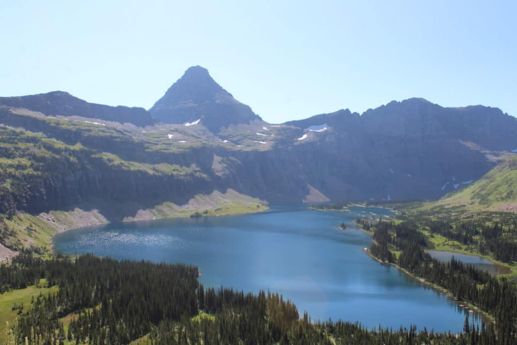 Length: 5.3 miles
Difficulty: Moderate
This hike is in addition to the Hidden Lake Overlook, so if you are headed from the Logan Pass parking lot then you will want to factor this in. This up-and-out trail offers plenty of opportunities to see mountain goats and clear water and is one of the best hikes in Glacier National Park. Take a picnic lunch with you and eat on the shore of the lake before gearing up for a semi-challenging hike back up the side of a mountain.
Alex from Alex on the Map
Half Dome Hike in Yosemite National Park
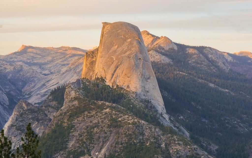 Length: 16.4 miles roundtrip
Difficulty: Strenuous
Half Dome is one of the most iconic trails in Yosemite National Park, and one of the most famous ones in California. The trail goes up the Mist Trail or you can take an alternative route with fewer stairs up the John Muir Trail. The cables are only up from the end of May through the first weekend of October.
This trail can be done as a long day hike, or to make it more enjoyable and easier, break it up into a backpacking trip.
Half Dome also is one of the hardest permits to get. It’s possible to hike the trail all the way up to the famous cables that take you to the top of Half Dome, but a permit is required to climb the cables. Just because it’s hard, doesn’t mean it’s impossible to get the permit. Here is more information on how to get the permit.
Jenny Kotlyar from Limitless Hiker
Lost Horse Mine Trail in Joshua Tree National Park
 Length: 4 miles, out-and-back type trail
Difficulty: Moderate
Joshua Tree National Park is no stranger to epic hikes through the incredible Southern California desert. On any trail you choose, you’ll see beautiful cacti, wild flowers if they are in bloom, stunning rock formations, and the iconic Joshua trees themselves.
However, there is one trail that really stands out in Joshua Tree and that’s Lost Horse Mine Trail. This 4 mile out-and-back type trail is a moderate hike that only gains 515 feet in elevation. The path takes you through the unique landscape of Joshua Tree and gives you a peek at the rich mining history that the area has become known for.
Lost Horse Mine was prospected for gold from 1894-1931 and over 10,000 ounces of gold and 16,000 ounces of silver were extracted from the mine. On the trail, you can still see remnants of the mining operation including mine shafts, equipment, and historic structures. The trail was even originally created back in the day to haul ore and supplies, so you’re traveling the path of miners!
Alanna Koritzke at Periodic Adventures
Abrams Falls Trail in Great Smoky Mountains National Park
 Length: 5 miles roundtrip
Difficulty: Moderate
Off of the Cades Cove Loop Road you’ll find a large gravel parking lot at the trailhead for Abrams Falls. It’s a popular hike so get started early in the day – this will also help you miss the afternoon thunderstorms!
The trail winds through the forest beside a creek for the majority of the way. The terrain gets a bit rocky and there are plenty of roots so it’s best to wear good hiking shoes. You cross a few low, narrow bridges just before you get to the falls.
Once you arrive at the falls there is plenty of space at the base so you can hang out and eat a packed lunch. Even though the falls are only 20ft high, it is one of the largest waterfalls by volume in the park.
The large pool at the base of the falls is gorgeous and looks very inviting but do not swim here!
Anna Cook from Paddling Space
The Highline Trail in Glacier National Park
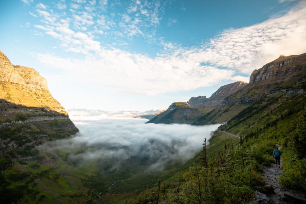 Length: 11.8 miles one way
Difficulty: Hard
The Highline Trail is one of the most popular trails in Glacier National Park. Starting at the Logan Pass Visitor Center, the trail passes through rocky cliffs and grassy meadows. The long hike takes you one way from Logan Pass and ends at the Loop along Going-to-the-Sun Road.
Along the Highline Trail, you’ll pass through glacially carved valleys, a signature of Glacier National Park. One of the best views in the park is a side trail up to a viewpoint above Grinnell Glacier called the Garden Wall. This side trail climbs one mile to the top of the Continental Divide. It’s a steep climb, but well worth the views of several lakes and a few glaciers.
This trail is also one of the best hikes for spotting wildlife in Glacier National Park. You’ll likely see plenty of mountain goats and marmots along the way. As this hike is one way, you’ll need to take the park shuttle back to Logan Pass from the Loop, or retrace your steps for an even longer hike.
Julia Jennings from a Well Planned Journey
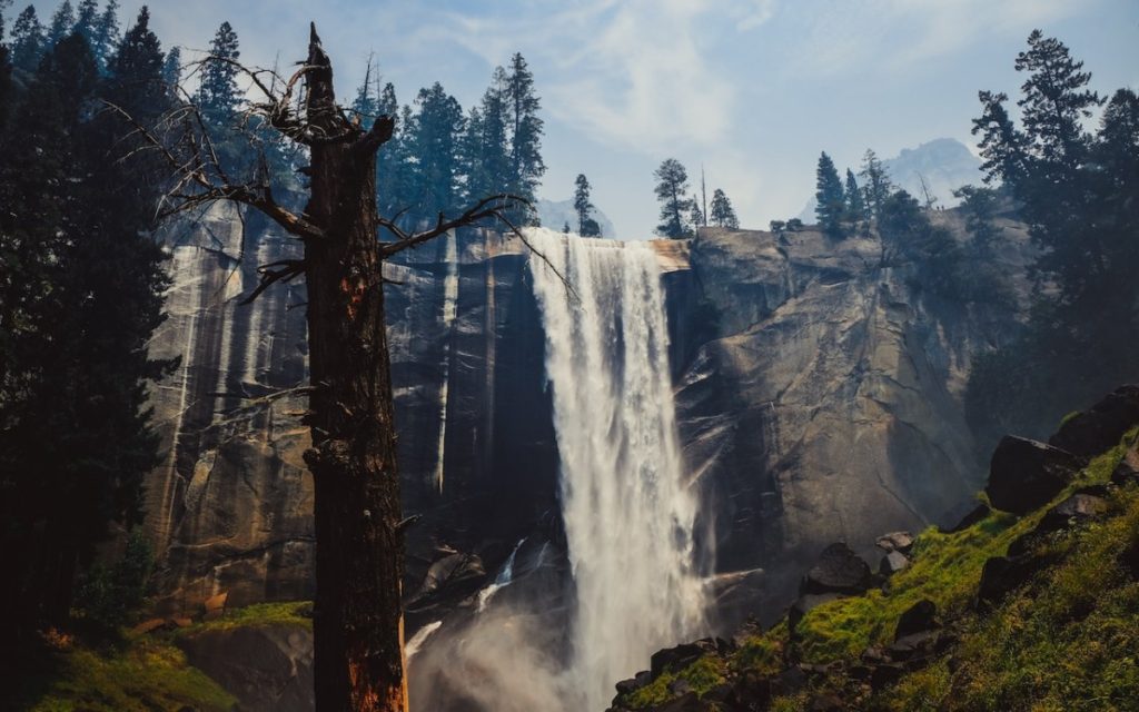
Vernal Falls Hike in Yosemite National Park
 Length: 4 miles
Difficulty: Moderate
Hiking to the peak of Vernal Falls in Yosemite, California, is one of the best hikes one can do in a national park. This moderate hike, also known as the Mist Trail, is about four miles long with an elevation gain of 1,279 feet. Visitors can find the trailhead next to Happy Isles Nature Center.
Hikers start out walking alongside the Merced River, surrounded by pine trees. As the trail gets closer to Vernal Falls, it turns into steps made from stone, allowing hikers to climb with a gorgeous view of the falls. At this point on the trail, hikers should indeed prepare to get wet. It’s lovingly nicknamed the Mist Trail due to the waterfall mist streaming down onto the trail, making it one of the best things to do in Yosemite on a hot summer day.
The views at the top bring the ultimate payoff. Visitors can walk right up to a railing at the top of the falls and watch as the water cascades down to the valley below. The Vernal Falls hike is usually completed in about three hours, and it’s best to get started in the morning to beat the heat and crowds.
Olivia from The Girl with Blue Sails
Notch Trail Hike in Badlands National Park
 Length: 1.5 miles roundtrip
Difficulty: Easy
One of the best hikes in the Badlands National Park is the Notch Trail Hike. This hike takes you through the rugged landscape of the badlands. The scenic canyon hike begins with a flat trail. As you make your way farther down the trial the canyon walls close in a little more. The best part is the “ladder.” There is a canyon wall that ascends up. The only way to keep going is to climb. It is very fun for all ages.
If you are hiking with children this may be the end of your hike if they are afraid of heights. Once you reach the top of the ladder you can proceed on a cliff trail that has a drop off. The trail rounds around the edge until you reach “The Notch,” which is a cut out in the rock wall. There is a spectacular view if you continue.
As you hike in the Badlands, remember that it is hot in the summer. Be prepared with sunscreen and plenty of water. It will be worth a little heat to see to explore this amazing hike.
Lisa Manderino from Planning Away
Big Room Trail in Carlsbad Caverns National Park
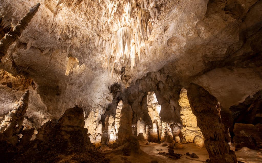 Length: 1.25 mile roundtrip
Difficulty: Easy
If you have limited time and there is only one thing you can do in Carlsbad Caverns National Park in New Mexico, take the Big Room Trail. The Big Room is the largest single cave chamber by volume in North America, and it’s breathtaking. The Big Room is almost 4,000 feet long, 625 feet wide, and 255 feet high at its highest point. Cave formations as stalactites, stalagmites, columns, curtains, straws of all shapes and sizes look like fairytales. It’s an easy, flat hike.
You start it after leaving the elevator. And it will take about 1.5 hours to walk it. Moreover, part of the trail is wheelchair accessible. If you want, you can make a shorter Big Room trail to about 0.6 miles by missing a second loop. But if you have more time, combine the Big Room Trail with a more difficult and steep hike Natural Entrance Trail, which is 1.25 mile long one way. It gives you truly an amazing cave experience and makes your visit to this underground national park complete. You can go outside using the elevator, which will save you time.
Agnes from The Van Escape
The Narrows in Zion National Park
 Length: 9.4 miles
Difficulty: Hard
There are plenty of great national parks in Utah, including Bryce Canyon, Canyonlands, and Capitol Reef, but Zion is by far the most popular.
One of the coolest and most unique hikes in Zion National Park is The Narrows. To complete this hike, hikers must walk in and along the Virgin River through knee to waist-deep water as the river twists and turns through some of the narrowest parts of Zion Canyon. At its narrowest points, the gorge is only 20-30 feet wide and has over a thousand foot tall walls on both sides. Exploring this part of Zion National Park is truly an incredible experience filled with beautiful scenery and impressive landscapes.
The best way to hike The Narrows is from the bottom up by taking the paved Riverside Walk trail to the river entry point at the Temple of Siawava. From there, hikers simply walk up river until they reach a point where they want to turn around and walk back. Typically people go one to two miles upriver before turning back around for a two-to-four-hour total hike.
The difficulty of hiking The Narrows depends on the time of year, depths of the water, and the river conditions. Summer typically has the best hiking conditions but the most tourist traffic and generally, close-toed shoes and walking sticks are recommended year-round for hiking over the slippery and uneven surfaces in the river.
Stéphanie Lange from Travanie Travels
Bright Angel Trail in Grand Canyon National Park
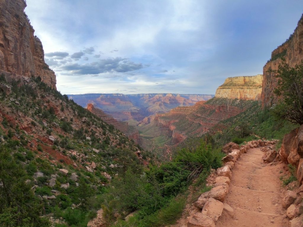 Length: Up to 12 miles round trip
Difficulty: Moderate to difficult, depending on distance hiked
If you don’t have a lot of time to spend in the Grand Canyon National Park, a hike at the South Rim is an ideal way to get a little further into the impressive canyon. As one of the three main hiking trails you’ll find at the South Rim, the Bright Angel Trail strikes the perfect balance between breathtaking scenery and a good hike.
Multiple turn around points make this a good option for hikers of many abilities, including kids. Switchbacks make a slow descent into the Grand Canyon and also makes the climb back up a little easier. But still plan for at least a moderate hike back up, with your return trip to be twice as long as the hike down.
There are sweeping views of the Grand Canyon the entire length of the trail. The first few miles have some stretches of shade that provide relief in the summer months –but also create ice-covered trails in the spring. We experienced many hikers slipping and sliding along the trail near the First Tunnel on a warm and sunny afternoon in March.
At the 1.5-mile point, the resthouse has water (seasonally) and restrooms making it an ideal turn around point for a moderate afternoon hike. Up for a longer hike? Stay on the trail to the three-mile Resthouse or Indian Garden to get a little further into the canyon.
Kiersten from Hiking in My Flip Flops
Emerald Lake Trail in Rocky Mountain National Park
 Length: 3.6 miles
Difficulty: Easy to moderate
Known for being one of the best hiking trails in Colorado, the Emerald Lake Trail is one of the dreamiest hikes in Rocky Mountain National Park if picture-perfect alpine lakes and stunning scenery are your jam! As far as mountain hiking goes, this is a relatively easy hiking trail that will have you making your way through jaw-droppingly beautiful alpine lakes that are better than the last (Bear, Nymph, Dream Lake, and finally, Emerald Lake), all of them backdropped by the most quintessential Colorado mountain scenery!
Meg from Fox in the Forest
Del Norte Trail in Channel Islands National Park
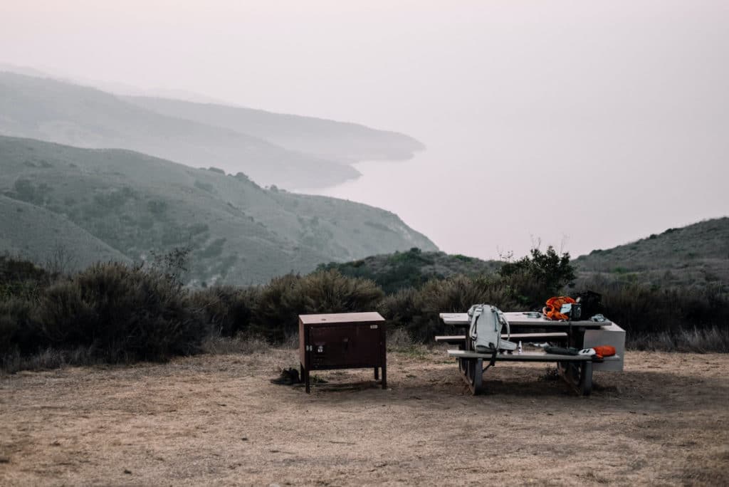 Length: 7 miles roundtrip, 3.5 miles one-way
Difficulty: Moderate
Located on Santa Cruz Island in the Channel Islands National Park, the Del Norte Trail is an exposed, moderately difficult 3.5-mile (one-way) hike with rugged coastal views nearly the entire way up. Starting in Prisoners Harbor, you begin the incline right away, hugging the hills on a wide dirt road. Once you come to a sign pointing you to Del Norte, you’ll follow a well-marked trail the rest of the way with some up-and-down sections, finally arriving at the Del Norte Backcountry Campground.
From here, you can either continue on four miles to Chinese Harbor, or if you have a camping reservation, you can set up camp on the island’s backcountry campground, with the Pacific Ocean below and some of the most epic sunsets ever! This hike is great because it gives you a nice overview of the scenery of the island, it’s well-marked, and the campground is well worth an overnight stay. Endemic to the island, you may see a Channel Islands island fox or two along the way, making the hike even more special!
Rachel-Jean Firchau from Rachel Off Duty
Moro Rock Hike in Sequoia National Park
 Length: 0.5 miles
Difficulty: Moderate
Moro Rock Trail is a moderately difficult but short 0.5-mile trail. There is very little parking at the trailhead and it is often closed all together. This requires hikers to park at the museum parking lot about two miles away. So, this trail often becomes a four-mile out and back hike. Don’t let that deter you–this trail is positively breathtaking and an absolute must see if you are going to visit Sequoia National Park! The two miles leading up to the trailhead are paved and covered with giant sequoias and other side trails to lakes and tunnel logs.
The trail itself is mostly steps carved into Moro rock itself. There are handrails to help you along and if you have a fear of heights this may be tested on this trail. The end result offers 270-degree panoramic views of the valley below and the Sierra Nevada.
Samantha Lorenz from Have Seat Will Travel
Guadalupe Peak in Guadalupe Mountains National Park
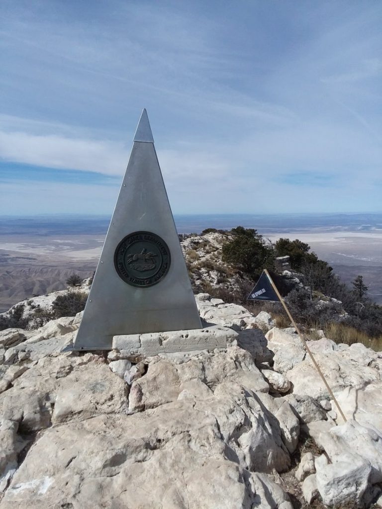 Length: 8.4 miles
Difficulty: Hard
This hike is literally the “top” hike of Guadalupe Mountains National Park. Considering that the Guadalupe Peak Hike heralds from Texas’s lesser known national park, this hike is a great way to get a unique perspective on this region. The hike to Guadalupe Peak is a 8.4-mile day hike, though you can primitive camp just below the summit and turn it into an overnight backpacking trip. It is on the easier side of difficult, with a small dosage of switchbacks, consistent, moderate incline, and a total elevation gain just shy of 3,000 feet, perfect for those day hikers who are looking for just a little extra challenge.
Hiking Guadalupe Peak also solidly defies the myth that Texas is all flat, as visitors will have a chance to stand on its 8,750-foot summit, which overlooks the rest of the Guadalupe Mountains range, the national park, the salt basins, and even into neighboring New Mexico, from the highest point in Texas!
The Guadalupe Peak Hike is also unique in that it seamlessly blends together a surprising myriad of environments and ecosystems. For the first mile or so of this trek, hikers start off in the high desert and shrubby environment of the surrounding Chihuahuan desert. Upon rounding the face of Guadalupe Peak, hikers are instantly surrounded by a transformation of ponderosa forests, before nearing the stark and cliff laden summit of the mountain. The views are equally as mesmerizing from this ceiling of Texas!
Kristen Czudak from Yonderlust Ramblings
Beehive Trail in Acadia National Park
 Length: 1.4 miles
Difficulty: Hard
Maine is home to the only national park in New England. Acadia National Park may be small and difficult to reach, but it’s worth the effort to visit. It’s possible to hike Acadia National Park in one day including one of the most popular hikes, the Beehive Trail. This short, yet challenging hike pays off with stunning views. Due to the technical parts of the trail (sections with iron rods and chain holds), this is considered a difficult trail for experienced hikers. The Beehive Trail starts off with relatively flat terrain.
There is only 488-feet of elevation gain, but it happens all at once. The popularity of this trail also adds to the difficulty, as it is common to encounter a line of hikers trying to climb to the top. Be sure to complete the Beehive Trail loop and do not descend the same way as the climb up. For the best experience, plan to hike the Beehive Trail during off-peak times and in good weather conditions. The views from the top of the beehive are a highlight of Acadia National Park.
Meg Alexander from Have Toothbrush Will Travel
Deep Creek Waterfall Loop in Great Smoky Mountains National Park
 Length: Options ranging from 2.5-5 miles
Difficulty: Easy
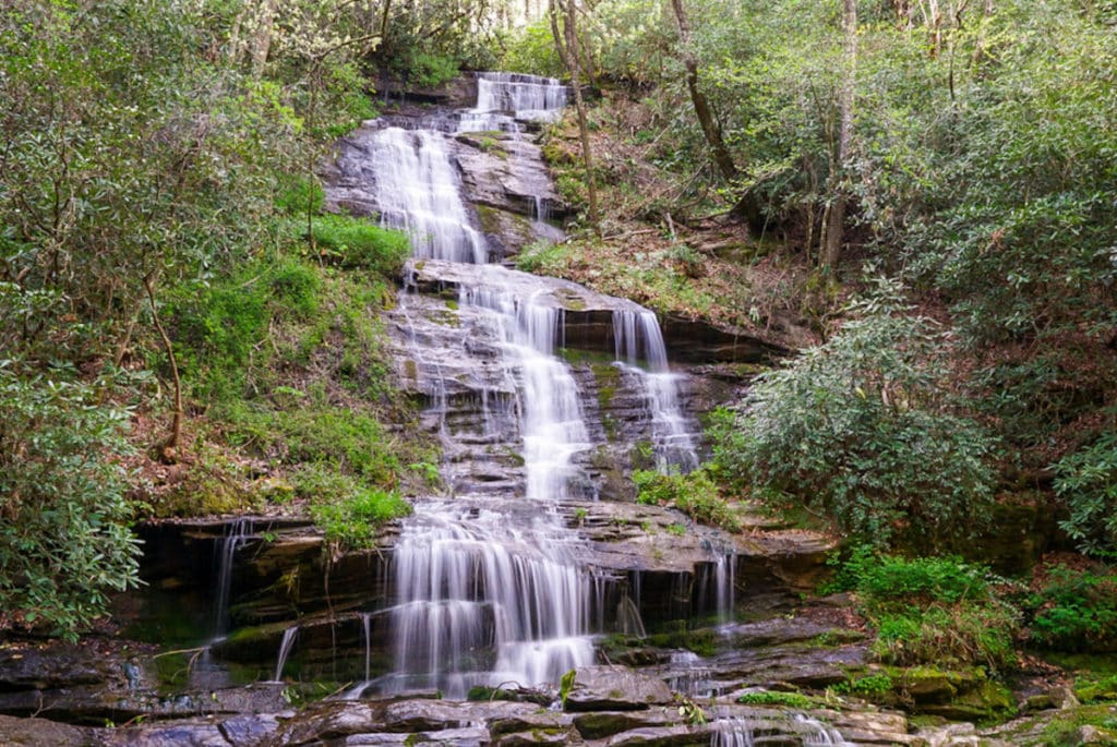
The Deep Creek Waterfall Loop in Great Smoky Mountains National Park takes you past three diverse waterfalls. You have a good chance of spotting wildlife–bears, deer and endangered salamanders are all common. And if you visit in spring, the mountain laurel blooms are spectacular.
The hike begins from the Deep Creek parking area outside Bryson City, NC. Start by walking to Tom Springs Branch Falls, 0.4 miles from the parking lot. Mountain laurels spill out of the trees on either side. Next, continue to Indian Creek Falls, which is on a short (signed) spur trail. This powerful waterfall slides down a rock face in front of the viewpoint.
If you want to keep your hike short, you can loop to Juney Whank Falls for a flat 2.5 miles. Juney Whank is the smallest waterfall on this hike–but if you explore the numerous viewpoints, you might find a rare Hellbender salamander!
Alternatively, continue from Indian Creek Falls up Juney Whank Ridge. It’s a moderate climb through the green tunnel, then drop back down to the river, where you can loop around to Juney Whank Falls. The full loop is five miles and it’s one of the best hikes in the Smokies.
Carrie Mann from Trains Planes and Tuk Tuks
Bush Key Trail in Dry Tortugas National Park
 Length: 1 mile
Difficulty: Easy
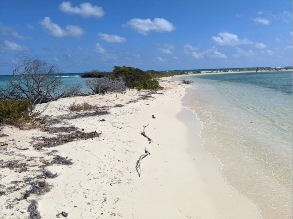
Southernmost parts of the United States are defined by the tropical climate. While it might seem that amazing beauty is the only activity here, there are actually a few well established trails that take you along the coast.
Bush Key Trail is very easy since there is basically no elevation. It is a nice coastal walk offering an abundance of wildlife spotting, like nesting coastal birds or sea turtles. This trail is primarily focused on hiking, walking, and nature observing, however, it does cut through shallow ocean at several points and can be closed seasonally due to nesting birds in the Caribbean. This beauty and essence of the Caribbean is best seen in the Florida Keys, a chain of islands extending from the southern tip of Florida into the Gulf of Mexico.
At the very end of those islands there are a few lonely islets and an old coastal fort that make Dry Tortugas National Park. Its waters are pristine and so blue that they don’t look real. It consists of seven small islands, and it’s most famous for Fort Jefferson Coastal Fort–though it also offers an opportunity for water sports!
Mary Biron from Dive In
Pipiwai Trail in Haleakala National Park
 Length: 4 miles out and back
Difficulty: Moderate
One of the best things you can do when visiting the Hawaiian Island of Maui is to hike the Pipiwai Trail inside the Kipahulu District of Haleakala National Park. This moderate four-mile out-and-back hike is heavily trafficked and one of Maui’s best hikes.
The first mile takes you by several lookouts where you can spot waterfalls gushing in the distance. Next you’ll come to an ancient banyan tree that makes a perfect spot to grab a drink of water and be mesmerized by its beauty.
Around mile two you start to enter a peaceful bamboo forest. You’ll instantly feel at ease as you listen to the sounds of the cracking bamboo swaying in the breeze. The towering shoots also provide dramatic shade from the hot Hawaiian sun so there’s never a bad time to hike this trail.
If you thought it couldn’t get any better you’ll arrive at the star of the show, a 400-foot waterfall known as Waimoku Falls. You won’t be able to swim under these falls but there are rocks to rest on before heading back to the start of the trail.
Waterfalls, enchanting bamboo forests and photogenic banyan trees make this hike perfect for the whole family and worthy of anyone’s bucket list.
Jess from I’m Jess Traveling
Old Rag Hike in Shenandoah National Park
 Length: 9.8 miles
Difficult: Challenging
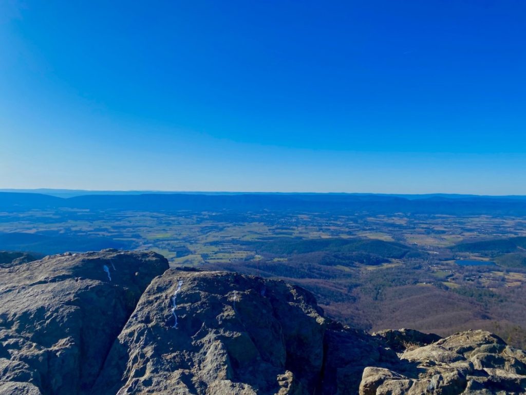
The challenging 9.8-mile Old Rag Hike at Shenandoah National Park has received numerous accolades, even counted among the best hikes in the world. Old Rag also regularly secures top honors as the most scenic hike in Virginia.
However, this hike is not for everyone. A solid mile of this hike is a fairly intense rock scramble. You’ve got to strategize rocky passages, slide down granite surfaces, navigate tight spaces and summon every ounce of strength to hoist yourself up onto rocks and boulders. Thankfully, you will be rewarded with 360-degree panoramas when you reach the summit of Old Rag.
There’s a lot of space to sit, snack and savor the stunning views of surrounding mountains. From here, the trail descends to reach Byrd’s Nest Shelter, a day-use shelter with a picnic table. In a few more steps, you’ll reach Old Rag Shelter, another day-use shelter with a picnic table. Near the end of the hike, stroll alongside cascading Brokenback Run. It’s a refreshing way to end your day at Old Rag.
While the majority of hiking trails at Shenandoah National Park are accessed from Skyline Drive, the 105-mile scenic byway that runs the length of the park, Old Rag is not one of them. This hike begins at a parking area on the outskirts of Sperryville, guiding hikers into the park from the eastern boundary of the park.
Erin from Go Hike Virginia
Mirror Lake Hike in Yosemite National Park
 Length: 2 miles
Difficulty: Easy to moderate
Yosemite is easily among the most popular wildlife spots in America. The Park, nestled amidst California’s Sierra Nevada Mountains, offers gorgeous views with every turn of the mountain road which make it a perfect weekend break destination as a trip from San Francisco–either for residents looking to escape from their busy lives or people who want to have some family fun on vacation days off work.
If you’re looking for accommodations in Yosemite National Park, then there’s plenty of options. Whether you want to stay outside the park or inside it, there will be something that works perfectly with your needs and budget. Visit during late spring/summer when temperatures are lovely but crowds are low.
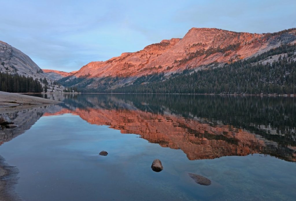
Mirror Lake is a picturesque spot for relaxation and one of the best views in Yosemite. The hike to Mirror Lake takes you along granite walls, through forests with towering Douglas firs, past waterfalls tumbling down from high cliffs above your head around pools that are refreshing on hot days.
Many hikers start their journey at stop number 17, but be careful because the first part of the trail can seem confusing. You’ll see that there are two paths–one on either side of a river. The right path is for hiking and leads up towards Mirror Lake; if you want to go only as far as this lake then take this one.
On your left-hand side, however, is an access road paved with asphalt which will lead you down below where Mirror Lake sits. It’s not nearly so beautiful or impressive but may provide more privacy from people around while you relax in nature.
Alice from Adventures of Alice
Lost Palms Oasis Trail in Joshua Tree National Park
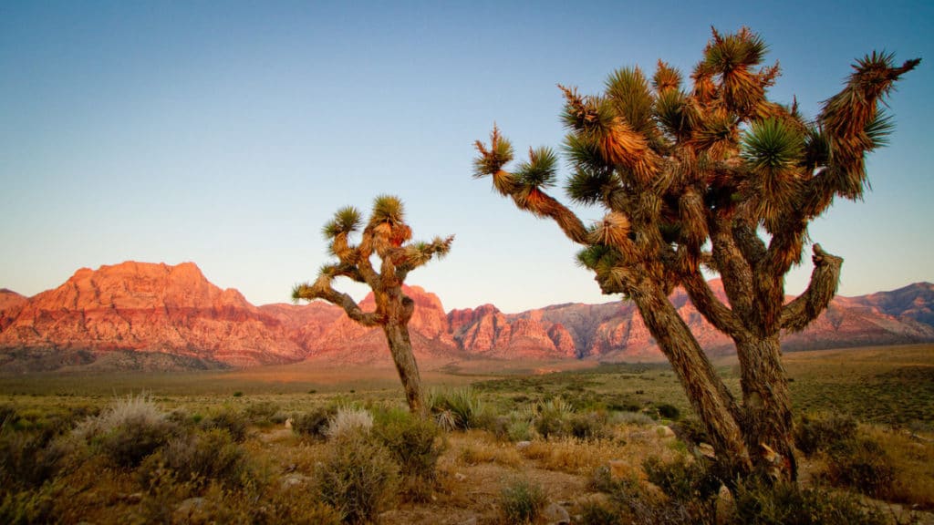 Length: 7 miles
Difficulty: Moderate
Joshua Tree National Park is one of my favorite places for hiking, climbing, and camping. The park spans both the Mojave and Colorado deserts, so hikers can experience completely different landscapes within one day in Joshua Tree. The Mojave Desert is home to the iconic yuccas and giant rock formations, while the Colorado Desert is hotter, drier, and full of cacti.
One of the best hikes in Joshua Tree is the Lost Palms Oasis Trail, found south in the Colorado Desert area. It is a moderate in-and-out 7-mile hike over rocky peaks, with lots of cacti marking your path. The hike leads to a lush oasis in the middle of the desert, complete with towering green palm trees. Hikers can climb down under the trees to enjoy the water and shade, but tread carefully–it can be slippery! This hike is also not typically recommended during hot summer months. Be sure to pack plenty of water and start early.
Monica from This Rare Earth
Meyer Beach Sea Cave Trail in Apostle Islands National Lakeshore Park
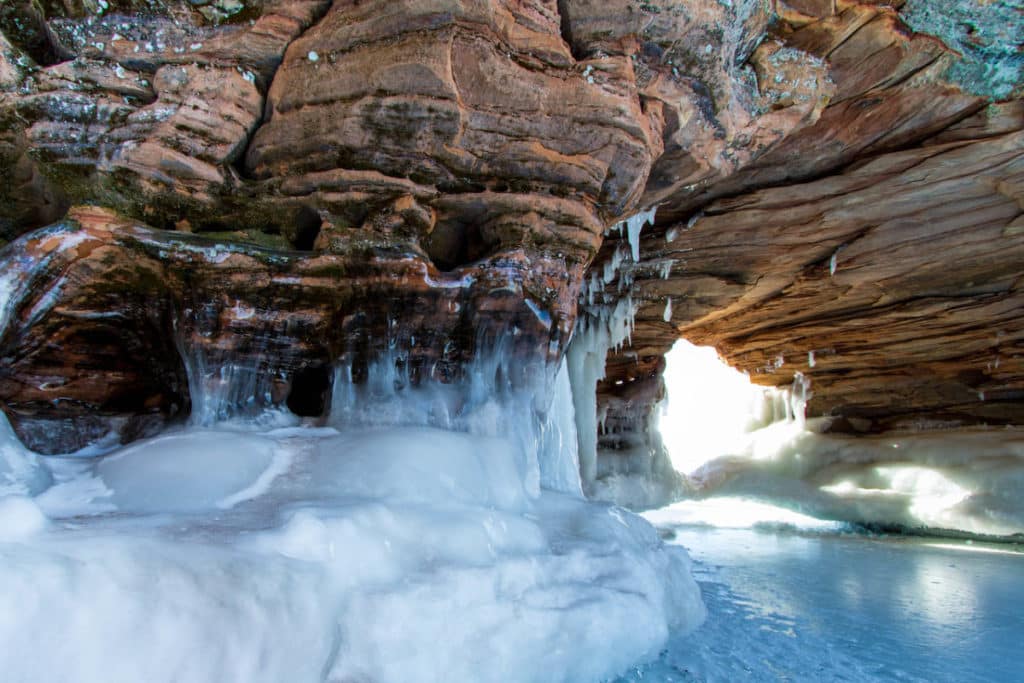 Length: 4.6 miles
Difficulty: Moderate
The Meyer Beach Sea Cave Trail is located in one of Wisconsin’s hidden gems, the Apostle Islands National Lakeshore Park. The trail provides a scenic view of the Lake and the forest areas found all around this national park. It’s a bit above a beginner’s level hike due to the terrain you need to hike across and the difficulties encountered along the way. It can get a bit muddy in some areas and icy in others, so it’s important to bring the correct footwear depending on the time of your visit. If you come during the winter, be prepared to slip a few times, but it’s also a perfect time to see the beautiful ice formations. Dogs are allowed on the trail, so it’s a perfect hike to bring them to get them to run through some energy.
Martin Soto from Travel Explorator
The Subway in Zion National Park
 Length: 9.1 miles (bottom-up), 7.8 miles (top-down)
Difficulty: Hard
If you are looking for a less popular option to the more infamous Zion Narrows or Angel’s Landing, consider hiking to the Subway at Zion National Park. This hike is located in Zion National Park, but not the area of the park where many other trails are located. Instead, the trail is located west of Springdale in Virgin, Utah off of Kolob Terrace Road. This is particularly important for planning purposes as it would be difficult to do this hike in combination with any of the other popular Zion National Park hikes on the same day.
There are two ways to hike to the Subway. The first option is to do a route that is referred to as “top-down” (think of this as a thru-hike) and the second option is referred to as “bottom-up” (think of this as out and back). Regardless of your direction you will need a permit. However, if you want to do the top-down route, you will also need canyoneering and rappelling skills as there are some sections where this is necessary.
The actual hike itself is rated as difficult, which is fitting as there is some scrambling required. Doing the bottom-up route is 9.1 miles and 1305 feet of elevation gain. The finale is very rewarding, with a beautiful subway-like formation in the canyon walls of North Creek.
Andrea Cannon from BeaUTAHful World
Christian Point Trail in Everglades National Park
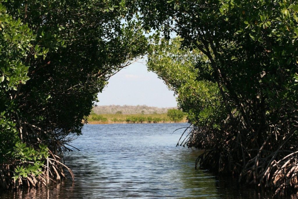 Length: 5.2 miles
Difficulty: Easy
If you are a nature lover and an adventure seeker, a hike in Everglades National Park must be on your bucket list. The Everglades are located in the southwest of the state of Florida and the park has been designated as a World Heritage Site by UNESCO.
The Christian Point Trail is one of the challenging trails in Everglades National Park. Although open, this trail is not maintained. You can expect rugged terrain, prairie, mangrove forest, buttonwood forest, tropical trees, and other flora. To access the trail, head to the Flamingo Visitor Center, follow Main Park Road north for 0.8 miles to the Christian Point trailhead on the right.
Stéphanie Beyens from Bey of Travel
Crater Lake Rim Trail in Crater Lake National Park
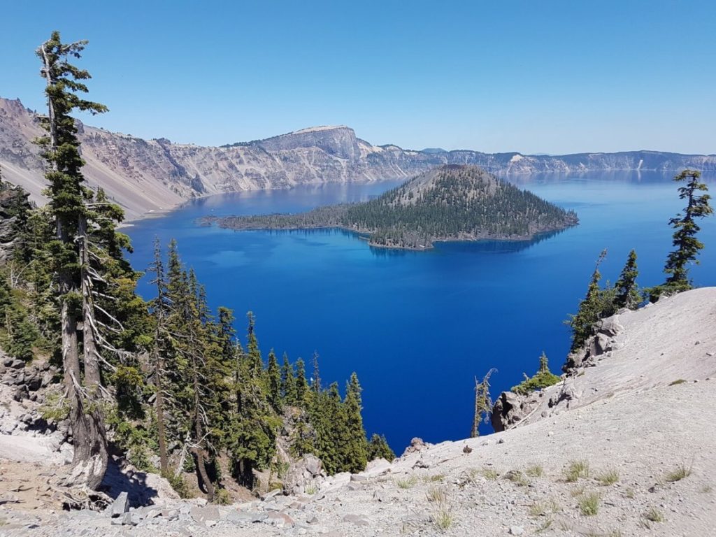 Length: 2.2 miles
Difficulty: Moderate
Crater Lake National Park, regarded as one of the best vacation spots in the United States, encompasses more than 80 miles of hiking trails. The Crater lake Rim Trail, also referred to as the Discovery Trail, is one of the best hiking options in this region. The appeal lies in the breath-taking vistas of the caldera, Wizard Island below, and the surrounding landscape. Access is at the west end of Rim Village parking area and ends at the famous John Hillman overlook. If the views weren’t enticing enough, there is also the possibility of seeing deer and elk early in the morning or evening.
You’re absolutely going to want to make this part of your Pacific Northwest road trip itinerary if you can. It’s a hike that is good for all ages and a perfect introduction to the beautiful nature in the area.
Rai from A Rai of Light
Do you have any favorite hikes in America’s national parks? Feel free to share in the comments!
Like this post? Save it for later!

Want more information on national parks? Check out these articles:

America’s National Parks are so dreamy, I’m gonna have to save this post for a future travel!
Yay! I’m glad this helps. Let me know if you need any more information.
Love the article I am 60 years old my favorite hike is Eagle Peak the tallest of the 3 brothers in Yosemite National Park starting in campground 4 Yosemite valley 6 .4 miles up 6.4 miles back stunning views including Columbia rock over Yosemite Valley little Yosemite Falls The cascades and of course Big Yosemite Eagles peak is about 2 .4 miles from the top of big Yosemite opens to a rock bench that seats two good views love to hike the timber line in Yosemite plan to do half dome June 15th Eagles peak June 16th